Geography in the
21st Century
a new class in 2003-2004!
|

|
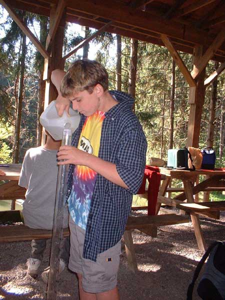
| Erik
Faber tests water quality on a field trip to Boughton Park. |
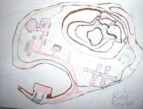
One of the first projects
the Geography Class attempted was making 3D maps out of layers of cardboard.
|
If there is one area in our school curriculum that does
not get the attention it deserves, it is geography. Well, we are trying
to bring "the study of the Earth" back into the classroom. Not your great-grandpa's
geography…memorizing state capitals and reciting the names of all the continents
and oceans in alphabetical order.
In the twenty-first century, we are interested in much more than rote memorization. Of course, you need to know the names of oceans and states if you call yourself geographically-literate. But students need to see connections between physical world and their world. They need to ask geographic questions like, "Why did New York State achieve success with the Erie Canal, and no other state came close?"
Or, "Why are tropical countries destroying their rainforests, and what can be done to prevent further destruction?"
In the Geography in the 21st Century Enrichment class, we will be investigating the Earth. There will be several projects throughout the year. Here are some of them. Watch for future developments starting in September 2003.
| Learning GIS: The
students in the Geography class will learn a powerful computer program:
Geographic Information Systems (GIS). They will learn how to create maps and to analyze data obtained from maps. We will be creating a Community Atlas as a major project. We will study the Victor community, and represent it with home-made maps and charts. It will be submitted to the ESRI Community Atlas Project for evaluation. See their website: http://www.esri.com/industries/k-12/atlas/ |
|
The EarthKAM Project is another exciting opportunity for our enrichment students. They "order" satellite images from the International Space Station. The geography class will be responsible for labeling and analyzing the images. |

|

|
The National Geography Bee: Victor students participated in a national competition that tested their knowledge of geography. This was the first time Junior High students ever took the bee challenge. The local competition was held in early-January 2004. It was organized by the Geography Enrichment Class, but it was open to all Victor Jr. High students. Casey McKee won the event, and Adam Urbanic was the first runner-up. Watch for updates in the winter of 2004 about the state competition! For more information about the Geography Bee, visit the NGS website: http://www.nationalgeographic.com/geographybee/ |